


One of the marvels of Bristol’s prestigious engineering history, Bristol's Floating Harbour has a long and interesting history.
The name comes from the fact that the water in the harbour remains at a constant level and is not affected by the tides of the River Avon which flows into it. We’ll go on to explain why.
Why was it created?
Bristol is situated on the River Avon, which flows into the Severn Estuary just a few miles downstream, and from there into the Bristol Channel, which has the second greatest tidal range of any river system in the world. At certain times of the year the water level in Bristol can change as much as 12 metres!
As you can imagine, this created both benefits and problems for visiting ships, which could end up stranded on the thick mud of the Avon if they didn’t time their trip well. As Bristol’s popularity as a cargo destination increased in the mid 1700s this became even more of a problem, and to stay competitive the Port of Bristol needed to come up with a solution.
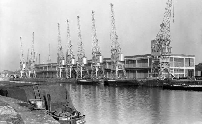
Image - Transit sheds and cranes at Princes Wharf in 1953
Design and construction
The first plans for a system to overcome the tidal range in the harbour were created by engineer John Smeaton in 1765, but it wouldn’t be until the early 1800s that the system we see today was designed by famous civil engineer William Jessop.
Merging the best ideas from earlier proposals, William Jessop’s final plan involved a lock system which extended from Hotwells in the west to Netham Lock in east, a distance of roughly 3.5 miles.
Cutting the harbour off from the tides of the River Avon means that the water level and current remain safe and stable for boats, as well as acting as a flood defence for the city.
Construction on the Floating Harbour started in May 1804 and was completed in May 1809. The harbour covers an area of 70 acres, including the locks and weirs at Hotwells and Netham, Cumberland Basin, the Feeder Canal and the New Cut, which diverts the tidal water away from the harbour.
The entire Floating Harbour network covers an area of 70 acres and features over 40 bridges criss-crossing its waterways. Discover these bridges and more on the Bristol Bridges Walk.
Discover more history of the Floating Harbour on this historical walk run by M Shed
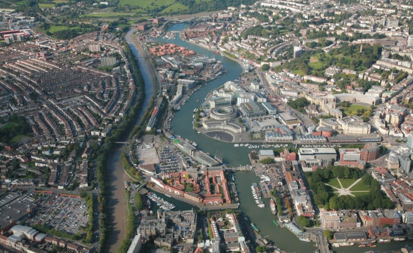
Image - An aerial view of Bristol Harbourside & the New Cut
Underfall Yard
In addition to the lock system and other huge engineering projects around the Floating Harbour, there was also a need to create a system to allow surplus water in the harbour to flow out.
The original engineer, William Jessop, created the Overfall Dam at the Hotwells end of the harbour to address this, but by the 1830s, silt was building up in the harbour. As with many Bristol problems, master engineer Isambard Kingdom Brunel came up with a solution to this problem. In place of the Overfall, he designed three shallow sluices and one deep scouring sluice between the harbour and the New Cut.
A drag boat would scrape the silt away from the quay walls. When the deep sluice opened at low tide, a powerful undertow sucked the silt into the river to be carried away on the next tide. The shallow sluices enabled adjustment of the dock water level according to weather conditions.
Several old buildings, which date from the 1880s, remain at Underfall Yard and have listed building status. The octagonal brick and terracotta chimney of the hydraulic engine house dates from 1888, and is grade II* listed, as is the hydraulic engine house itself. It's well worth exploring the mechanics and exhibits at Underfall Yard Visitor Centre and stopping off at Underfall Cafe to take in gorgeous views of the harbour.
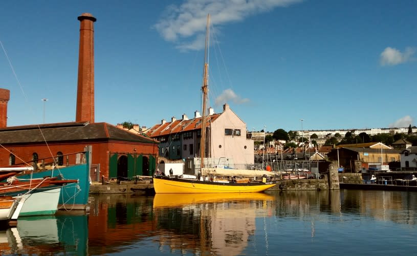
Image - Underfall Yard
Attractions
The Floating Harbour ceased operating as commercial docks in the 1970s. Since the 1980s, millions of pounds have been spent regenerating the harbour for leisure and tourism. The city’s working docks are now located at Avonmouth and Portbury, a few miles downstream.
In 1999, Pero's Bridge was constructed, followed by @Bristol (now We The Curious) in 2000, along with an IMAX cinema, which now hosts occasional film events, while the rest of the building is occupied by Bristol Aquarium.
The Cumberland Basin & Baltic Wharf are used by a variety of small boats at Baltic Wharf Sailing Club and Bristol Marina, while the old hydraulic pumping station has been converted into The Pump House a proper pub in a Grade II listed building.
The harbour is now a hub of activity for residents and visitors alike, with several museums and galleries on the water’s edge, including Arnolfini, Watershed and M Shed. The Bristol Harbour Railway, operated by M Shed, runs between the museum and Bristol Dockyards during school holidays and other dates during the summer months.
- See artefacts from Bristol's maritime history on a Behind the Scenes Tour at M Shed
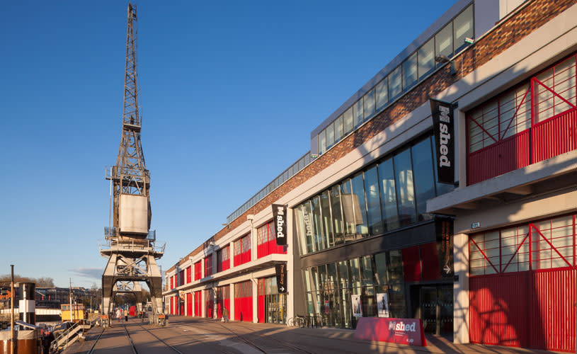
Image - M Shed
Several historic boats are also moored outside M Shed, including steam tug Mayflower, firefloat Pyronaut, motor tug John King, and a replica of John Cabot’s ship The Matthew, which was launched in 1997 to coincide with the anniversary of the ship sailing to North America in 1497.
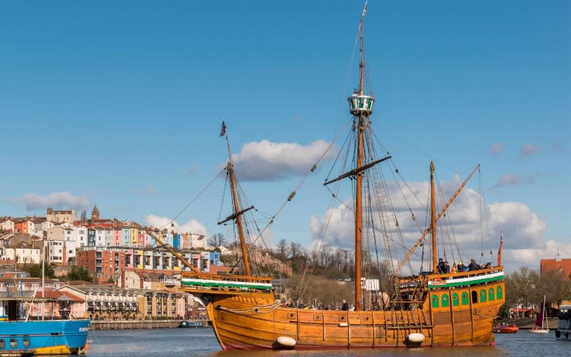
Image - The Matthew in the Floating Harbour, credit Carolyn Eaton
Bristol Ferry Boats and Number Seven Boat Trips operate ferry services along the harbour, serving landing stages in the city centre and close to most of the harbour-side attractions. Bristol Packet Boat Trips offer regular harbour tours with commentaries and river cruises throughout the year.
In late July each year, the Bristol Harbour Festival is held, resulting in an influx of boats, including tall ships, Royal Navy vessels and lifeboats.
Read more: