


 6 min read
Explore Bristol by rail and on foot with these five walking routes from Miriam Ricci at Railwalks.
Bristol's local rail network, with the famous Severn Beach Line connecting different neighbourhoods, opens up a different way of exploring the city. Rather than driving to the start of a walk and back again, Railwalks helps people create journeys between stations, connecting parks, neighbourhoods, heritage sites and green spaces by train and on foot.
That's the idea behind Railwalks, a volunteer-led project I co-founded to help people walk Britain by rail. My fellow Railwalks co-founder Steve Melia has recorded hundreds of enjoyable walks linking stations across the whole of Britain, revealing everything from remote countryside, hills and coastline to unexpected green spaces in the heart of cities. The walks below showcase just some of the routes that can be explored by rail. GPX files for all walks are available from an interactive map on our website. They can be downloaded and opened in your preferred walking app.
Redland to Temple Meads: My favourite parks and gardens in Bristol (7 miles)
Starting at Redland Station, the walk passes through the attractive surroundings of Cotham Gardens before entering the pedestrian-friendly neighbourhood of Kingsdown. From there, it continues through the peaceful Royal Fort Gardens, before reaching Brandon Hill, where sweeping views across Bristol reward the gentle climb.
The route then passes through the elegant Georgian setting of Queen Square before crossing the river towards Victoria Park and Perrett Park. Perched above the city, Perrett Park offers one of Bristol's finest skyline panoramas, with dramatic views stretching across rooftops, church towers and the surrounding hills, especially at sunset.
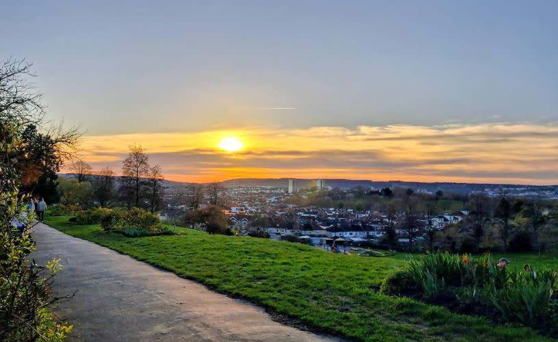
Image - Sunset from Perretts Park in Totterdown, credit Railwalks
Along the way, walkers will also discover some lesser-known treasures, including Berkeley Square, Bristol Cathedral Gardens, the Quakers Burial Grounds in Redcliffe and the gardens surrounding St Mary Redcliffe Church, one of Britain's most remarkable parish churches. The walk concludes beside the River Avon before reaching Temple Meads Station via its quieter rear entrance.
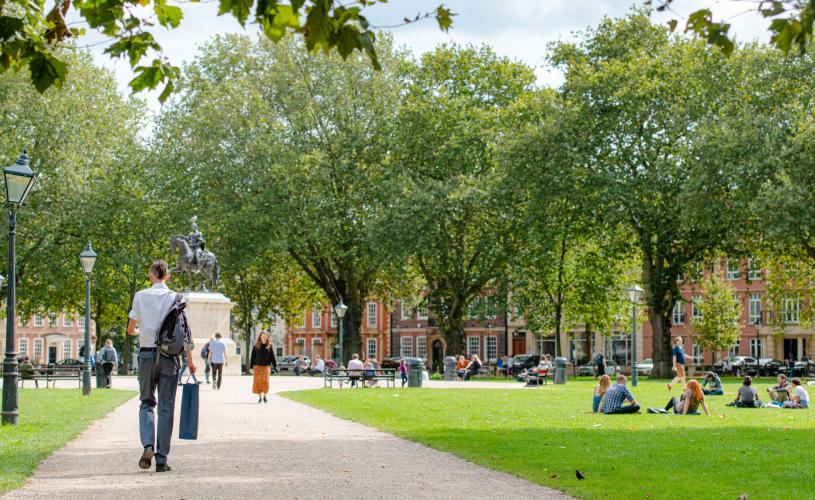
Image - Queen Square
Ashley Down to Filton Abbey Wood: Views from Purdown (3 miles)
One of Bristol's newest stations provides the starting point for a surprisingly scenic walk. Opened in September 2024, Ashley Down Station sits close to Purdown, a long ridge of green open land that connects with Stoke Park Estate.
The route climbs gently through grassland towards the summit, where a transmitter mast and a Second World War gun battery stand above the city. From this elevated position, spectacular views open up across Bristol and the surrounding countryside.
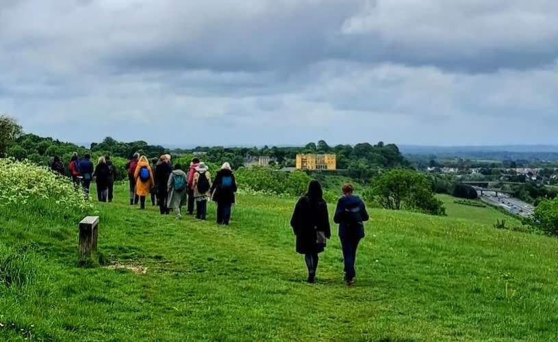
Image - Stoke Park Estate, credit Railwalks
The hill is also becoming known for its conservation grazing project, with goats helping to manage the landscape around the historic gun emplacements.
After descending through Stoke Park and crossing Lockleaze, the walk finishes at Filton Abbey Wood Station, which offers frequent rail connections across the region.

Image - Goats at Stoke Park Estate, credit Railwalks
Shirehampton to Sea Mills: Bristol's hidden countryside (6 miles)
Despite remaining entirely within Bristol's boundaries, much of this walk feels remarkably rural. Woodland paths, open grassland and long-distance views create the impression of being far beyond the city.
Starting from Shirehampton Station, the route climbs through the historic Kings Weston Estate to Kings Weston House, where views stretch across the Severn Estuary towards Wales.
Following sections of the Community Forest Path, the walk continues through a mixture of woodland and open landscapes to Blaise Castle, which was actually a folly rather than a castle!
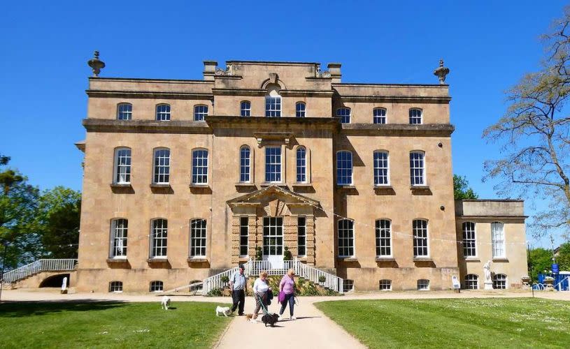
Image - King Weston House, credit Railwalks
The route then descends into the wooded gorge of the River Trym, a landscape so secluded that it hardly feels suburban at all. The final section follows the river through a green corridor of woodland and meadows before arriving at Sea Mills Station.
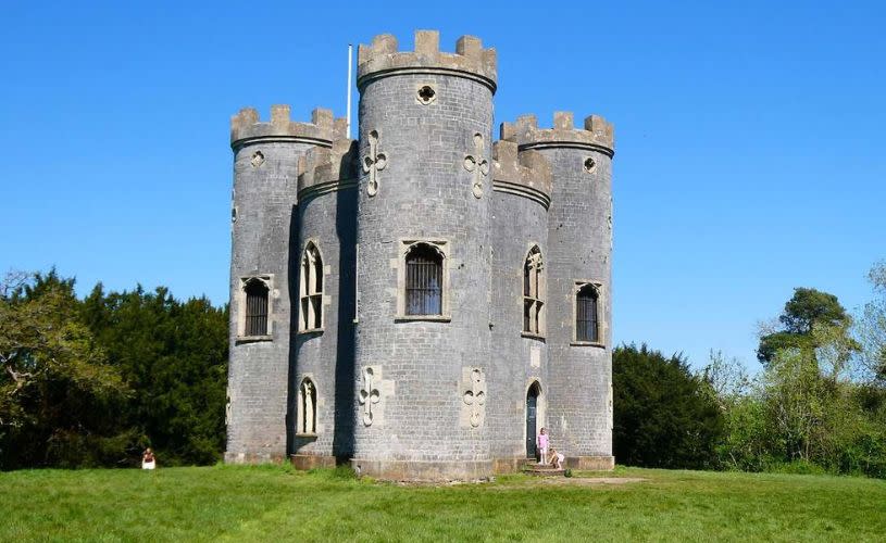
Image - Blaise Castle, credit Railwalks
Parson Street to Temple Meads: Bristol from above (3 miles)
This short urban walk packs an impressive number of viewpoints into just three miles. Beginning at Parson Street Station, it climbs through the Northern Slopes Nature Reserve, where elevated positions reveal broad views across different parts of the city.
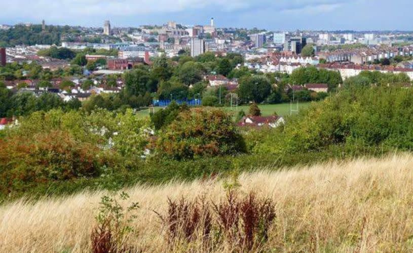
Image - Northern Slopes in Knowle, credit Railwalks
The route continues along the ridge before descending towards Windmill Hill and Victoria Park, another example of how closely green space and urban development sit alongside each other in Bristol.
Passing through Totterdown's colourful streets, cafés and pubs, the walk eventually crosses the Avon New Cut before following the waterside path towards Temple Meads and the rapidly developing university district around the station.
- Read our local guides to Windmill Hill and Totterdown

Image - Aerial view of Totterdown, credit Joshua Perrett
Temple Meads to Montpelier: Two miles through Bristol's history (2 miles)
The shortest route in the collection is also one of the richest in history. Beginning from the side entrance of Temple Meads, the walk follows the Floating Harbour through an area that continues to be transformed by regeneration. One of the highlights is the historic shot tower, a listed structure linked to Bristol's role in eighteenth-century lead shot production.
The route then enters Castle Park, home to the surviving remains of Bristol Castle and a landscape shaped by both medieval history and Second World War destruction. From there it passes eighteenth-century almshouses, Quakers Friars and a sequence of fascinating historic districts.
Brunswick Square and Portland Square showcase some of Bristol's finest Georgian architecture before the walk finishes along vibrant Picton Street, a characterful neighbourhood of independent shops and Victorian terraces, ending at Montpelier Station.
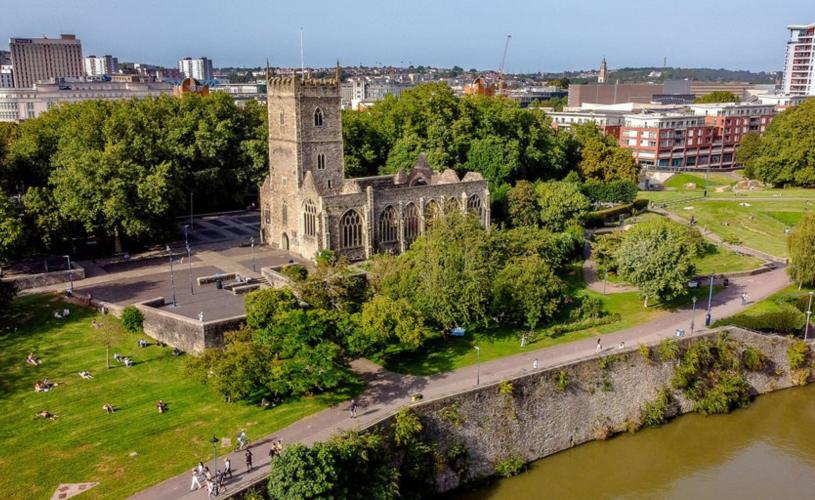
Image - Castle Park and St Peter's Church
Whether you're looking for city views, hidden woodland, historic streets or tranquil parks, Bristol's railway stations provide gateways to walks that reveal a different side of the city. With regular train services connecting many neighbourhoods, it's never been easier to leave the car behind and discover Bristol one station at a time.
If these walks inspire you to explore Bristol by rail and on foot, why not sign up to the Railwalks mailing list to hear about new routes and projects? We're also always looking to grow our directory, so if you've created a great station-to-station walk of your own, in Bristol and beyond, we'd love you to share it and help more people discover the joys of walking by rail.
Read more:


